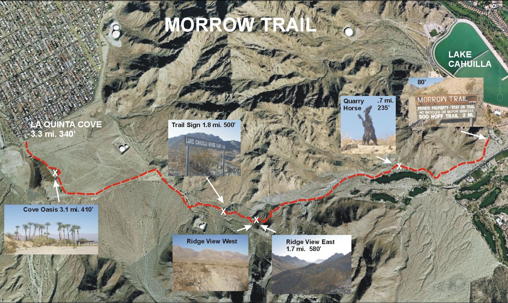
Morrow Trail map, Lakje Cahuilla. Here's a better map, in doc form, of Boo Hoff, Morrow, and Coral Mountain Loop Trails.
La Quinta Cove Hikes - Bear Creek Canyon Oasis Trail - Boo Hoff Trail - Guadalupe Trail
In the summertime the Bear Creek Canyon Oasis Trail is a particularly grueling hike. Temperatures often exceed 100º at the base of the trail, though if you can sweat it out and persist for 2 hours and 1900 feet of elevation gain, you will be rewarded with rare shade and a 10º temperature differential at the top in the palm grove. As of August 2013 the plants are dying off big time. Probably 80% of the ocotillo are dead, and most of the other plants are not far behind. Maybe this is a drought cycle, but some of the palms and other trees that I've seen felled by this so-called natural event are 30 years old or more. I believe the massive die off of the area is exacerbated by the near constant chemtrailing of heavy metals over the US and other G-20 nations. The plant and soil micro-organisms are poisoned, and moisture that would fall as rain is held in suspension in the air. When I can I will post photos of the other hikes in the area.
For more information check out the Examiner.com piece on Hiking the Bear Creek Trail (pdf), or an excellent series of La Quinta area hike reviews at EveryTrail.com that integrate Google terrain maps and photos indicating where along the map they were taken in a very informative and easy to use fashion. Here's a Hiking in Palm Springs article on the Bear Creek Canyon Trail (pdf).
Photos/Pictures/Photographs - August 6, 2013
Morrow Trail map, Lakje Cahuilla. Here's a better map, in doc form, of Boo Hoff, Morrow, and Coral Mountain Loop Trails.
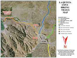
La Quinta Cove maps distributed by the City of La Quinta. Includes mileage details for: the Cove to Lake Trail; Boo Hoff Trail; the Bear Creek Canyon Oasis Trails; and Bear Creek Trail. The City puts out a brochure with the above map and a second page with safety tips and other information.
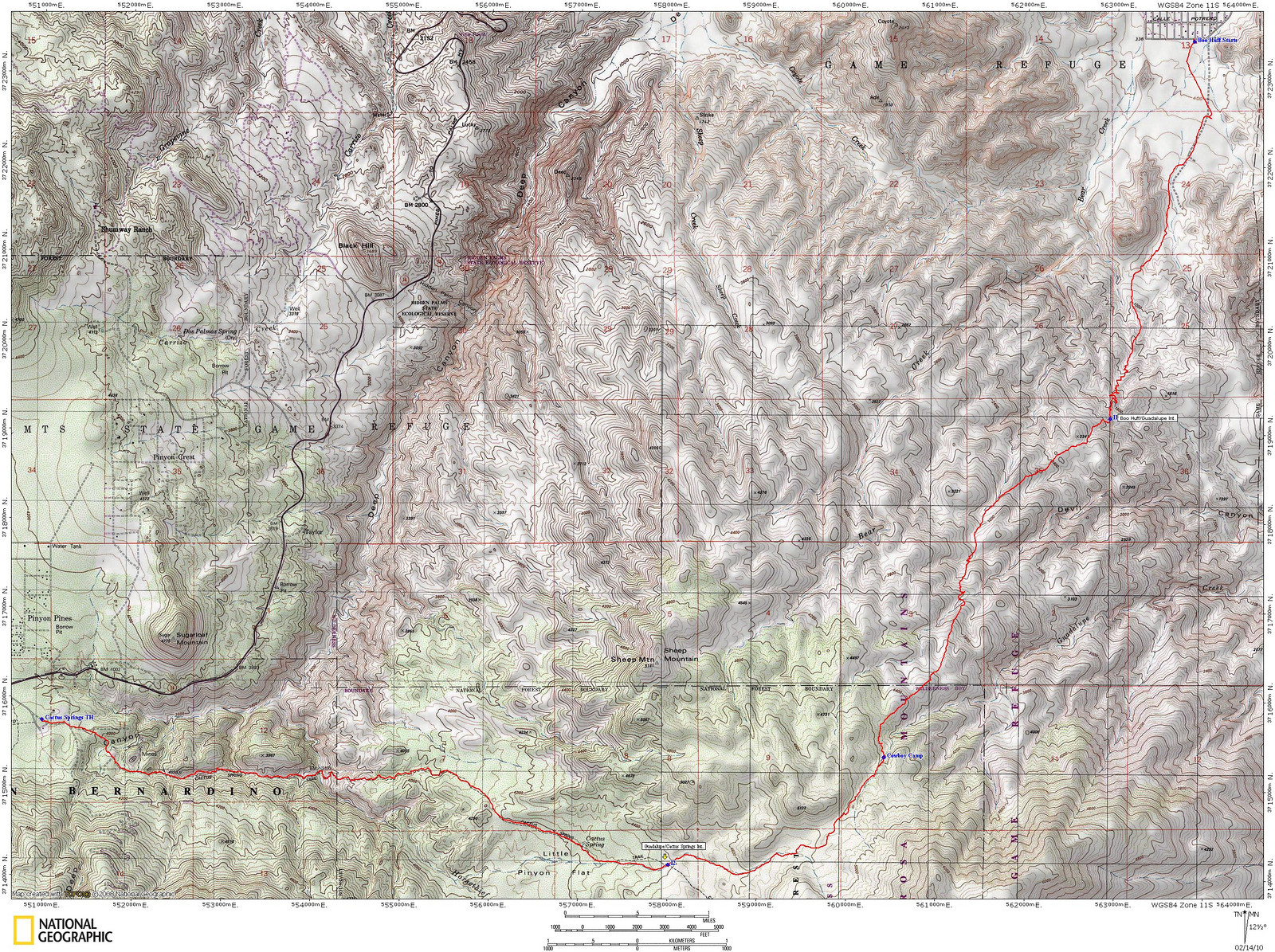
National Geographic topo map of Boo Hoff Trail to the Guadalupe Trail to the Cactus Springs Trail (thank you Kathy Wing). Kathy has an impressive series of Southern California Desert hikes, with nice slideshows for each.
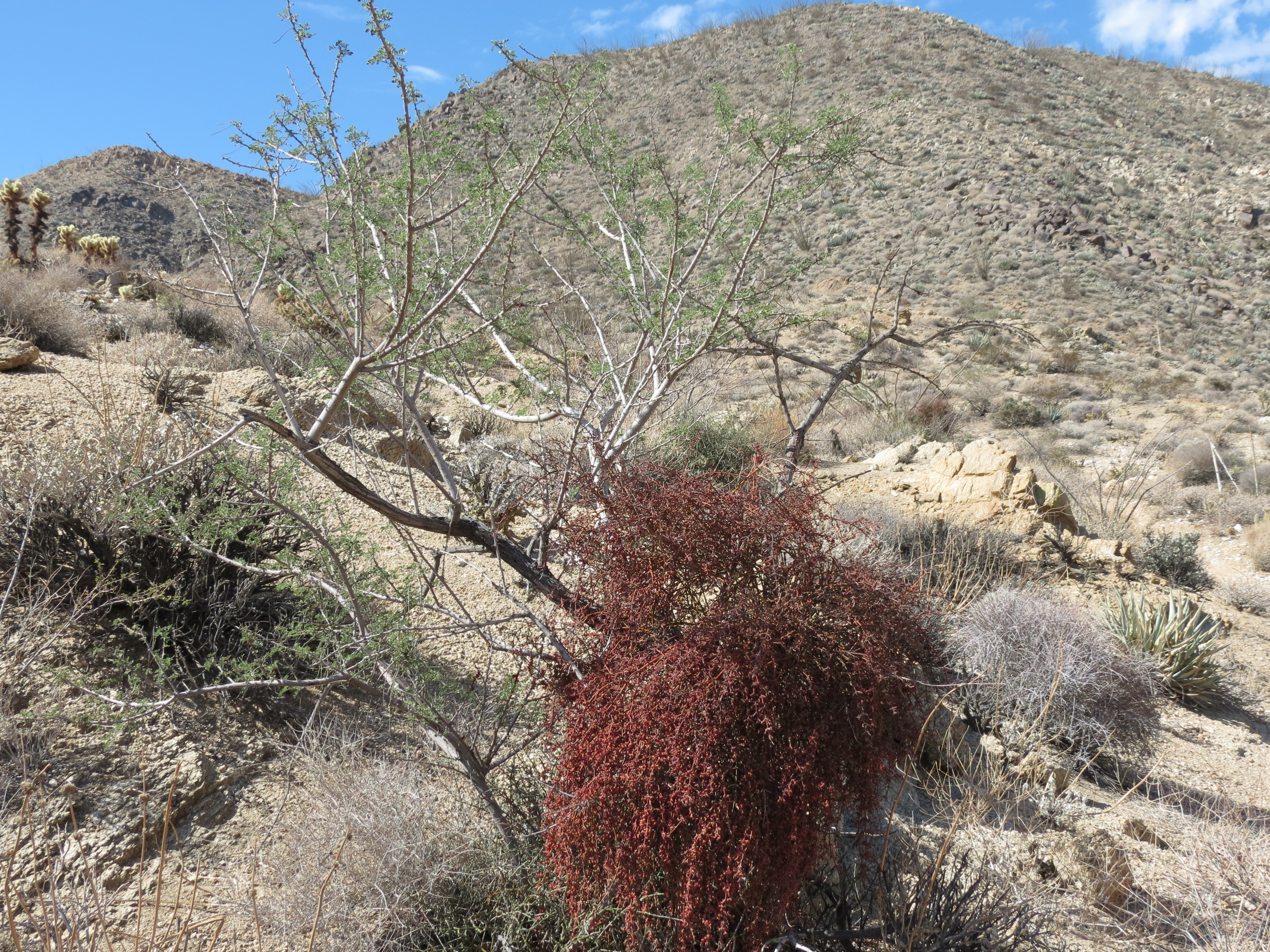
Bear Creek Canyon Oasis Trail, near top, fucking mistletoe killing yet another fragile desert plant. 8/4/2013.
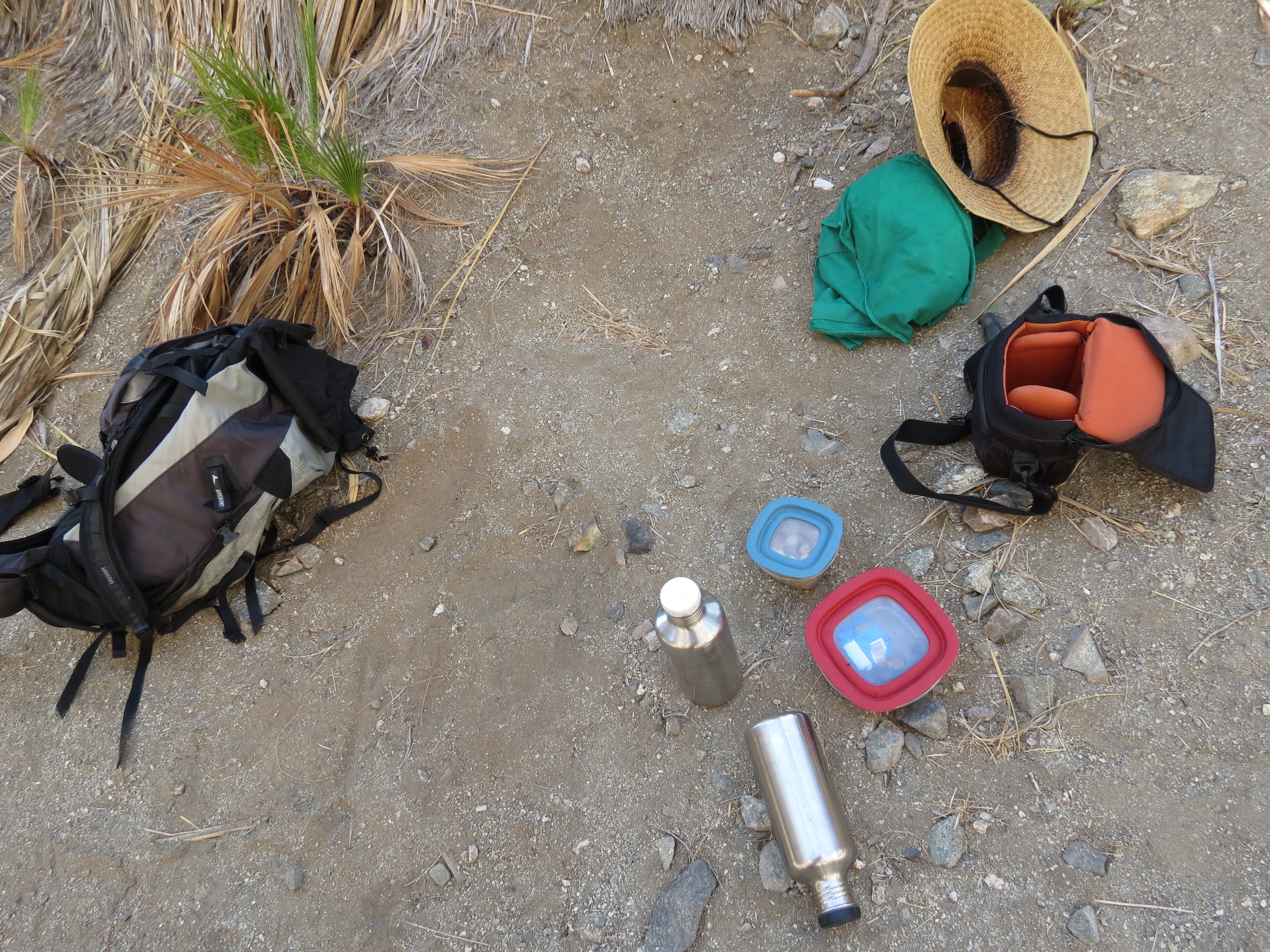
Bear Creek Canyon Oasis Trail. hiking gear, LowePro camera bag, Klean Kanteen stainless steel water bottles, straw hat, Gregory Adze backpack, Rubbermaid food containers. 8/4/2013.
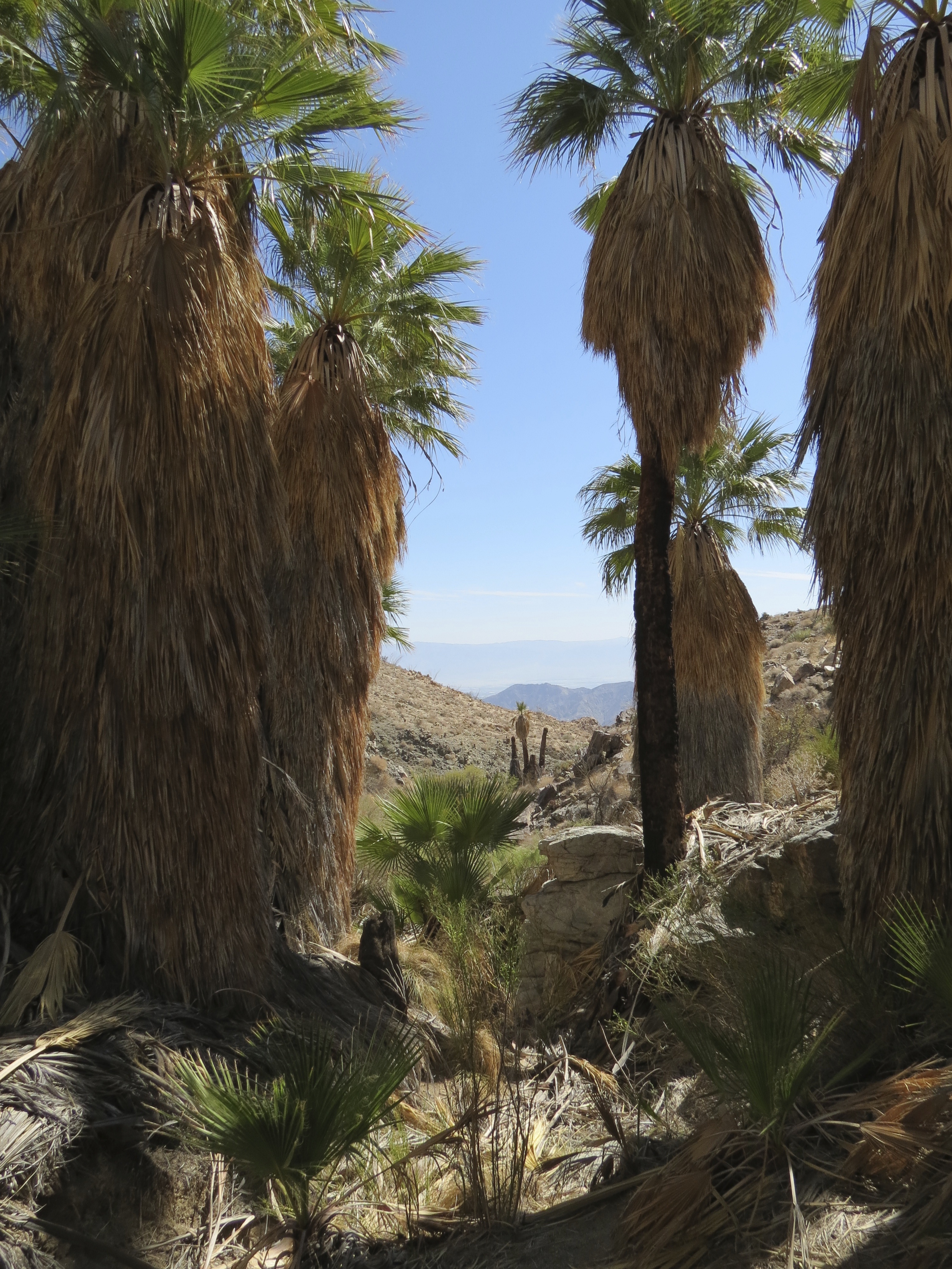
Bear Creek Canyon Oasis Trail, at the end of the trail, palms looking toward Coachella Valley. 8/4/2013.
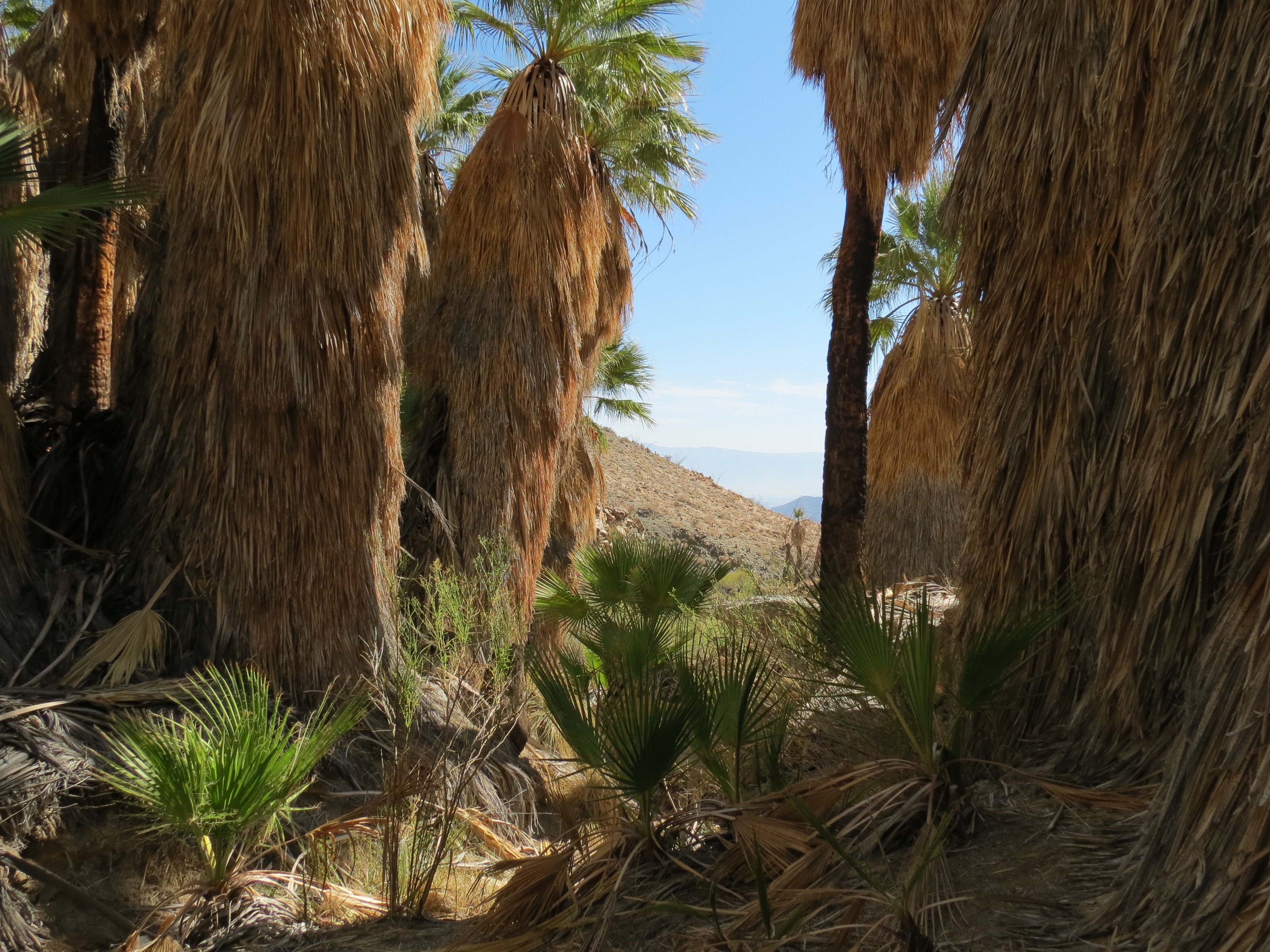
Bear Creek Canyon Oasis Trail, at the end of the trail, palms looking toward Coachella Valley. 8/4/2013.
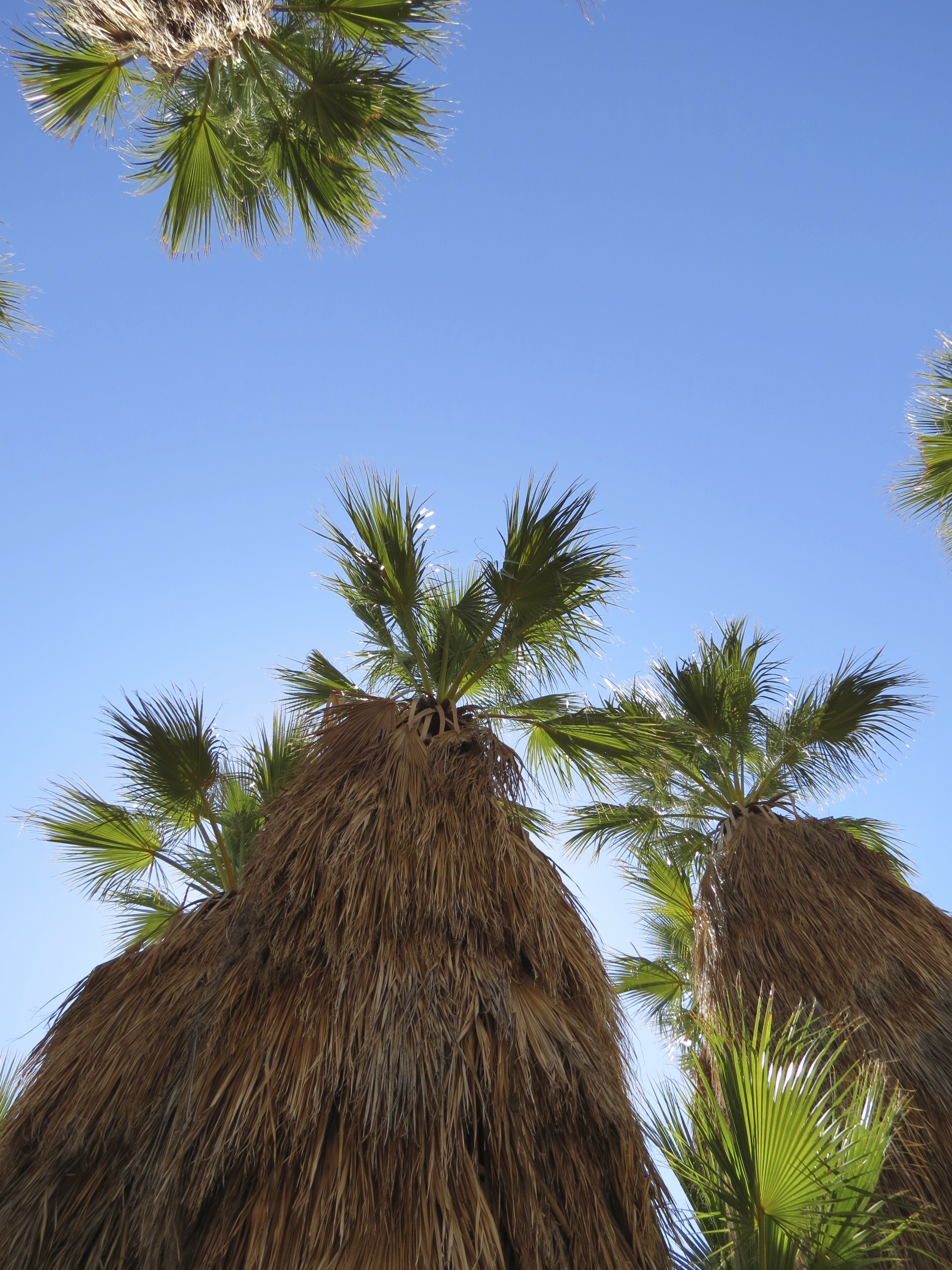
Bear Creek Canyon Oasis Trail, palms looking up to the sky. 8/4/2013.
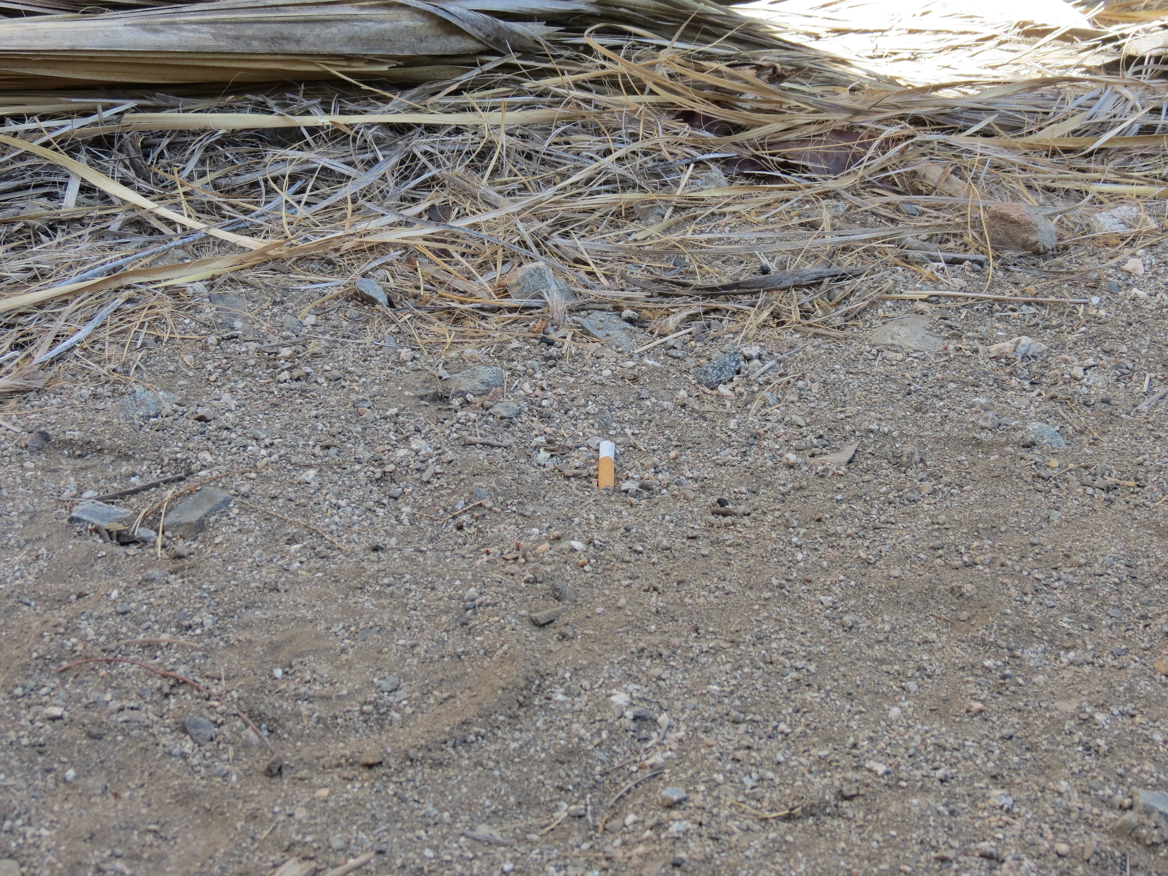
Bear Creek Canyon Oasis Trail, at the palm grove, dude's cigarette butt at one of the few areas clear of frond debris where a tired hiker can sit. 8/4/2013. This is the only shade the 4-5 hour round trip hike offers, so enjoy it. It's 10 degrees cooler up here than along the wash at the bottom, so it is pleasant even if it is still 90º. I do prefer high elevation hikes during the summer, but there is nothing convenient in the area that is at the 7000' elevation level. There is a respectable 1900 feet of elevation gain on this hike, starting at 300' at the street in La Quinta Cove and ending at the grove at 2200'. No water up here. I wonder where the big horn sheep slake their thirst? Maybe their urine has no fluid like the desert lizards? I ask, because the guide books say that this area was originally intended to be off-limits during summertime so that endangered mammals in the area could drink and shelter. But if there is no water here, then what do these animals do? I did see hoof prints from what looked like a solitary big horn the following day, but only lower down the trail, not up here.
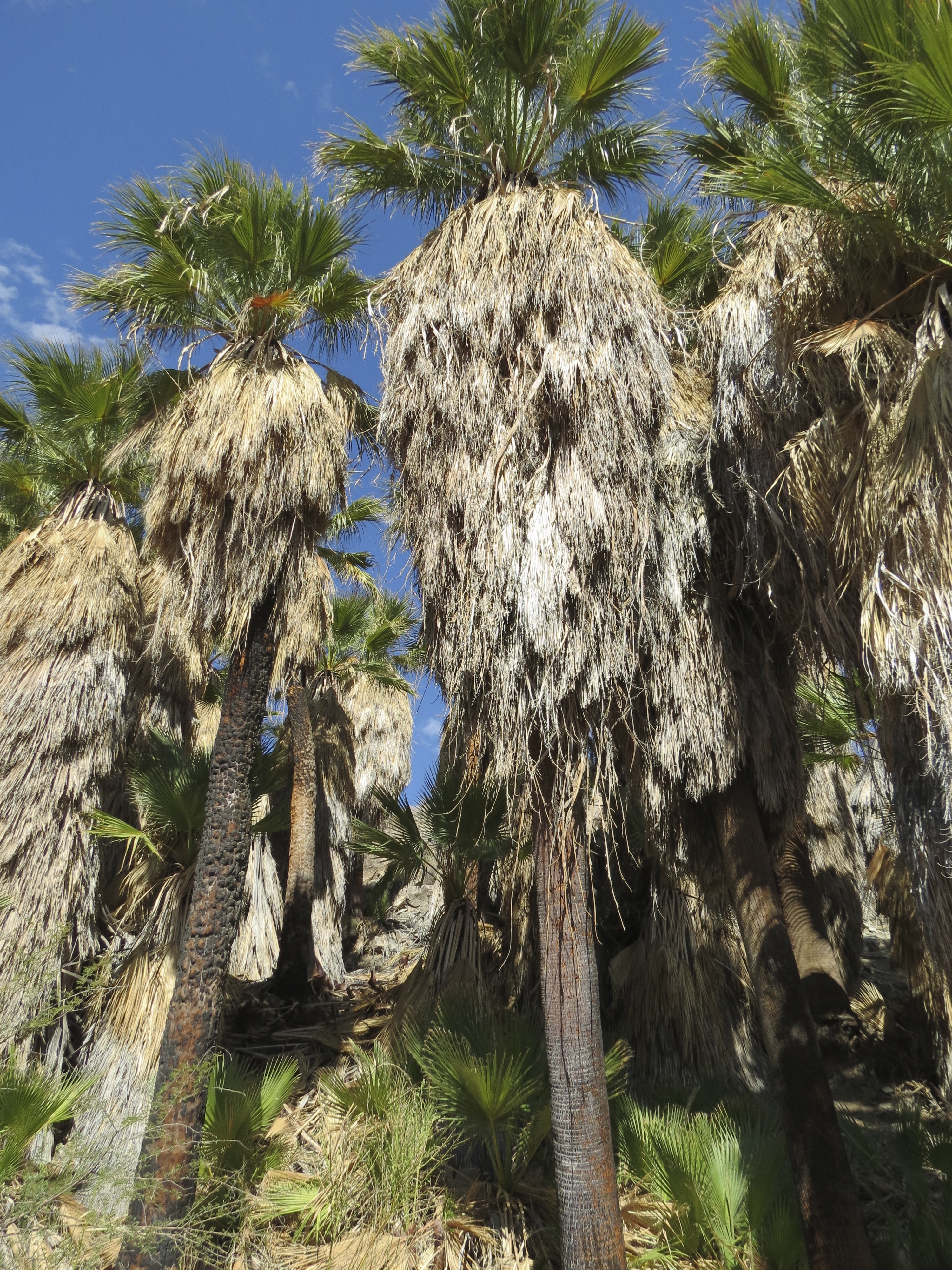
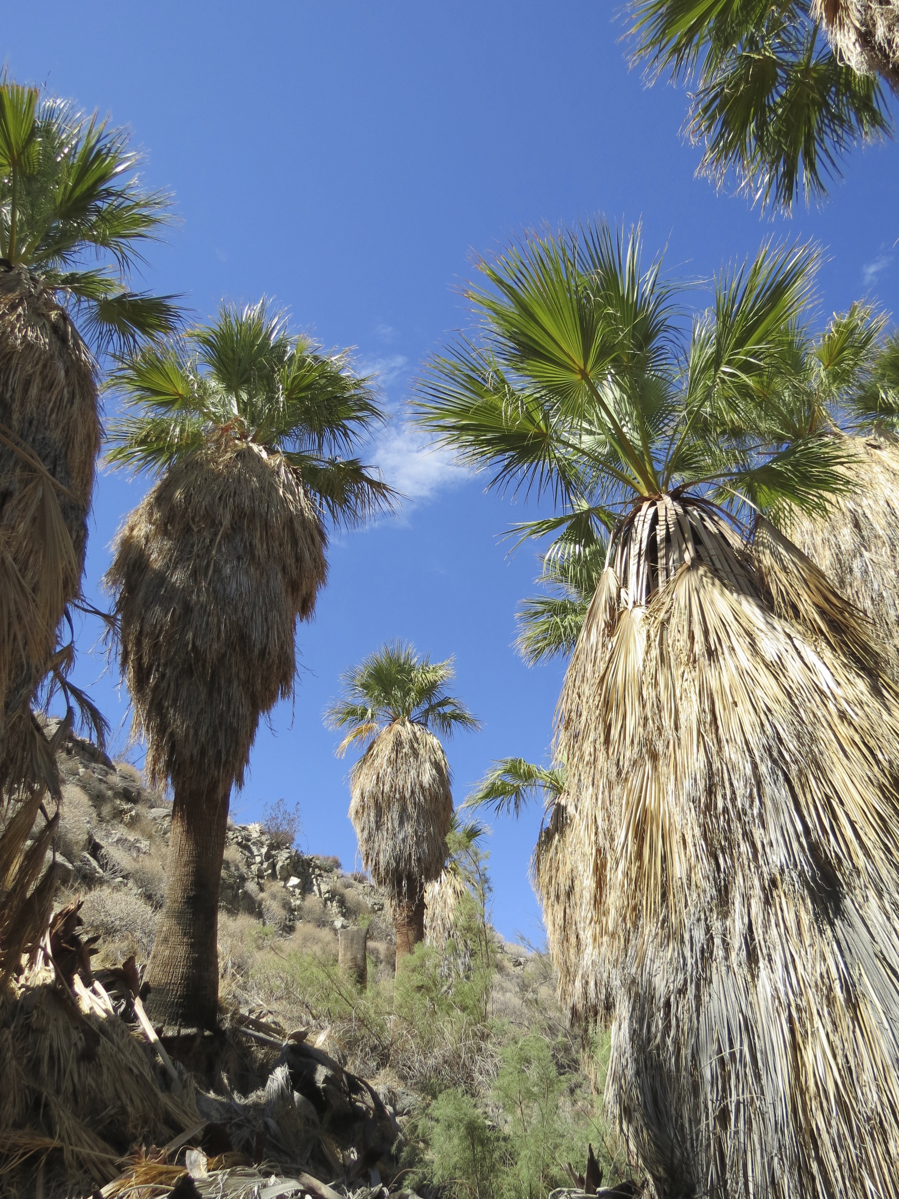
Bear Creek Canyon Oasis Trail, nice stand of palms. 8/4/2013.

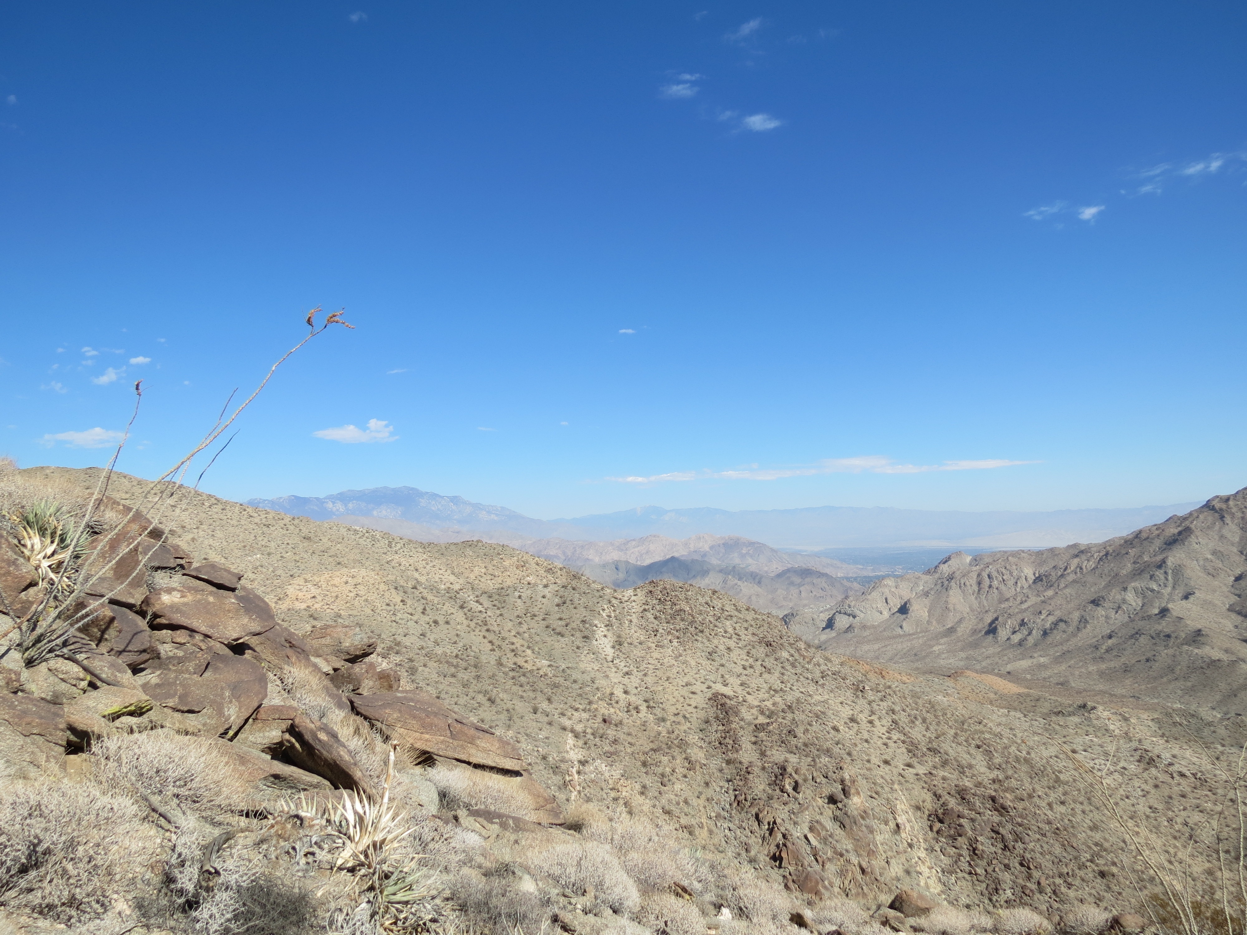
Bear Creek Canyon Oasis Trail, at high point of trail, looking to palm oasis in the distance, still 15 minutes to go. 8/4/2013.
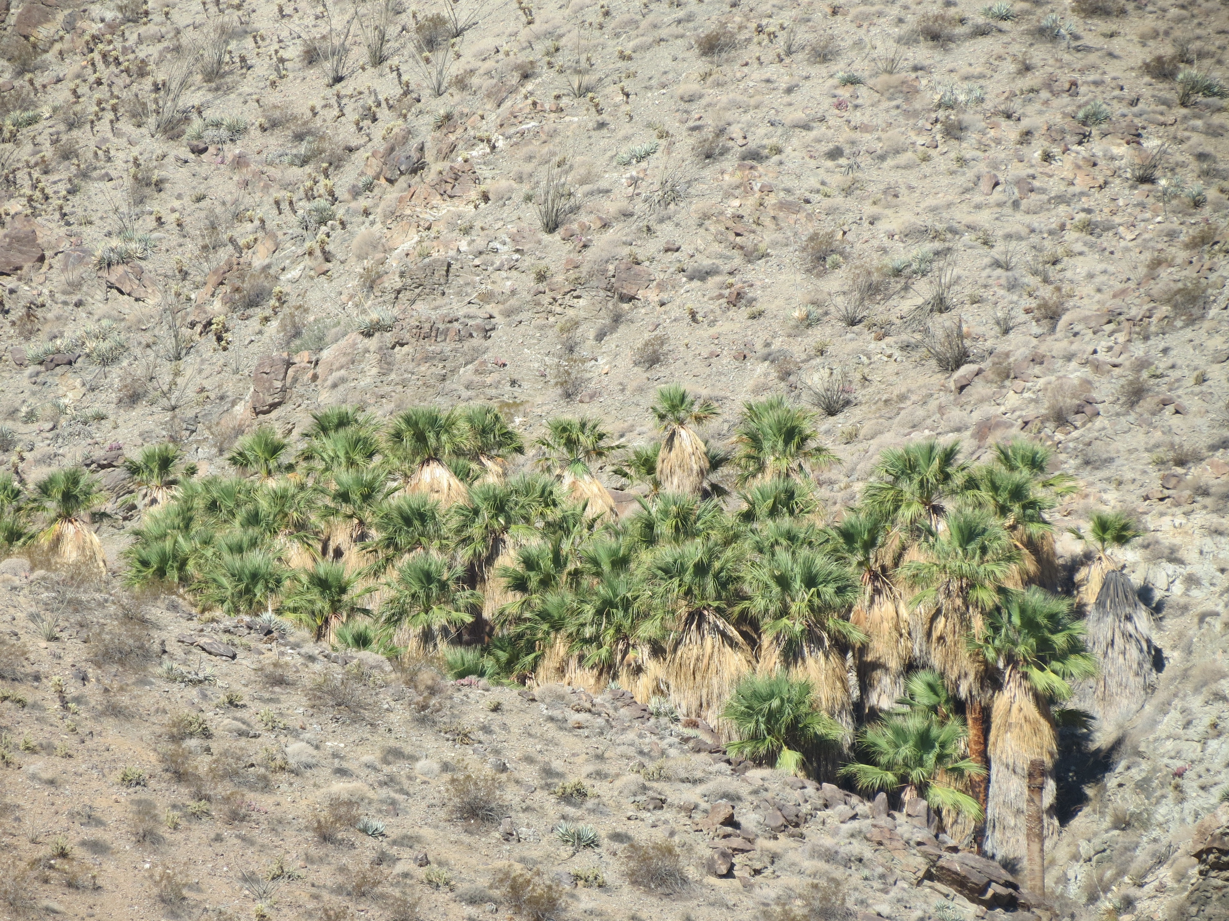
Bear Creek Canyon Oasis Trail, zoom photo of oasis from trail high point. 8/4/2013.
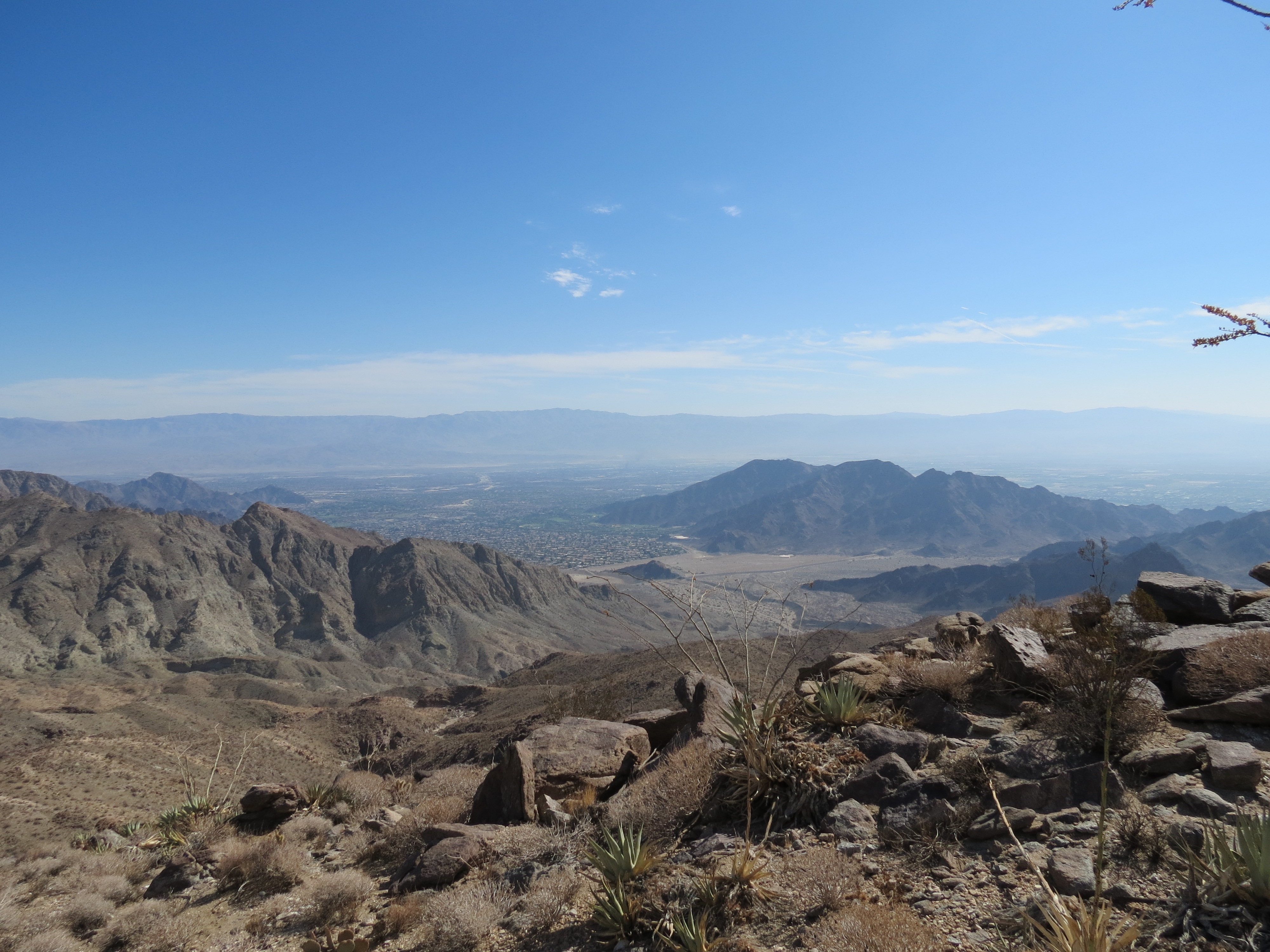
Bear Creek Canyon Oasis Trail, near the top, view of La Quinta Cove from high on the mountain. 8/4/2013. Across Coachella Valley are the mountains that form the edge of 1400 square mile Joshua Tree National Park.
Bear Creek Canyon Oasis Trail, near top of trail, looking northwest toward San Jacinto and San Gorgonio Mountains. 8/4/2013.

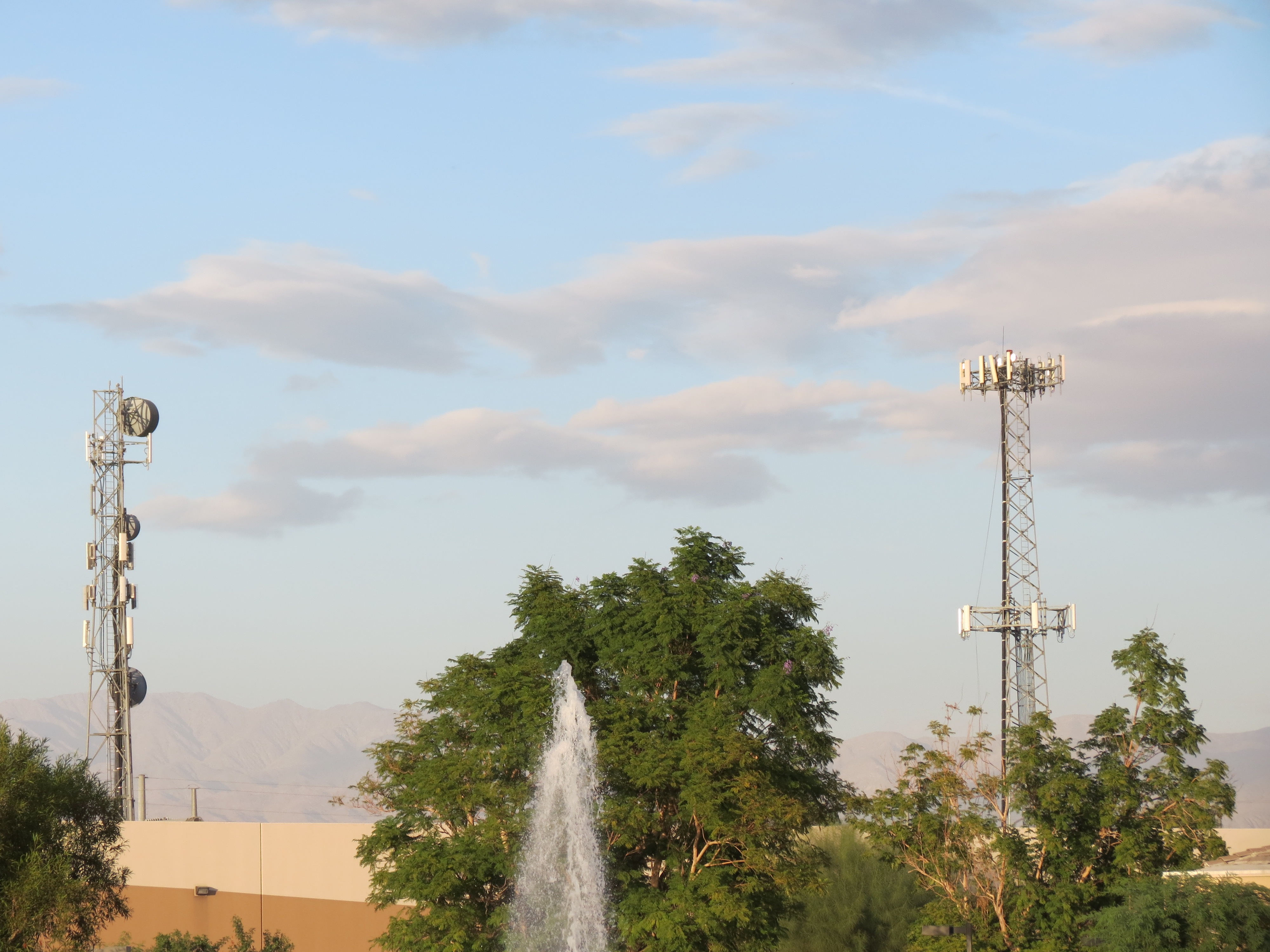

The Imperial Irrigation District located at 81600 58th Avenue La Quinta, CA 92253. It's about 1 1/2 miles east of Lake Cahuilla County Park. The EMF is very strong at this location and I would hate to work here. All the trail heads near Lake Cahuilla have strong electromagnetic exposure. By comparison, the La Quinta Cove area is much better, but is certainly not great, as it has full cellular receptivity. The farther away from the Cove parking area I get the better I feel. Lake Cahuilla is nearby, just a mile or two away, but it is blocked by some low 1000'-1800' mountains. They do good job of providing EMF shelter from the stronger electropollution presence near Lake Cahuilla. However, as the Boo Hoff Trail ascends, near its apex and intersection with the Guadalupe Trail at 1800', you are in direct line-of-sight to the facility shown above at the Irrigation District. Of course, you are a mile or two farther away from the facility than Lake Cahuilla is, and hence the exposure is reduced, but it is still not good. Hiking in areas with stronger EMF exposure leave me feeling weak and irritable. At least the Guadalupe Trail heads westward and away from civilization; but it does travel upward, and often this means the trail just begins to pick up additional manmade EMF reception as it gains higher vantage. It's 8/11/2013 as I write this, so it is a bit hot for an additional 3000 feet of elevation gain, but I look forward to following the Guadalupe Trail a few miles this winter.

I grabbed this image from Hiking in Palm Springs.
Criminal Aerosol Spray Operations - AKA "Chemtrails"
Electrical Sensitivity, Human Health, And Environmental Illness
Electrical Sensitivity - Personal Symptoms And Reflections
Healthful Diet And Lifestyle, Environmental Toxins, And Multiple Chemical Sensitivities
Heart Chakra Opening - Signs And Symptoms
Kundalini Awakening - Spiritual Signs And Symptoms
Kundalini Awakening - Spiritual Signs And Symptoms - Additional Posts
Kundalini Awakening - Spiritual Signs And Symptoms - EMF Complications - More
Kundalini, Orgasm, Masturbation And The Spiritual Function Of Sexual Fluids
Sexual Deviancy And Its Relation To Fear, Control, Power, Vitality, Innocence, Youth, and Death
This page was first uploaded on 8-6-2013, last modified on 8-6-2013.
All contents and design by Kundalini & Cell Towers © 2013-2016